Fast Facts About Otty Lake

Here are just a few fast facts you may be interested to know about Otty Lake.  For a full description, consult the 2007 Report on the State of the Lake Report, pages 13-19.

Otty Lake Aerial

Aerial Image of Otty Lake – Summer 2009
Download a full size copy of this image

Location

  • Otty Lake is located in Lanark County, Ontario, 5 km southeast of the Town of Perth
  • the lake lies in a south-westerly to northeasterly direction (44° 50’ N, 76° 13’W)
  • it spans the boundary of two townships: Tay Valley Township and Drummond/North Elmsley Township

Size

  • Otty Lake has a surface area of 6.4 km2 (2.5 sq mi)
  • its total shoreline length is 35 km (22 mi)
  • Otty is approximately 131 m(429.8 ft) above sea level
  • the lake is 9.2 km (5.7 mi) long, 1.2 km (0.8 mi) wide with a surface area of 6.4 km2 (2.5 sq mi)
  • the shoreline is rocky and irregular with outcrops as high as 30 m (100 ft)

Depth

  • the lake’s average depth is 9 m (30 ft) and its maximum depth is 27 m (90 ft)
  • southwestern portion: average water depth of 12 m (40 ft) and maximum depth of 27 m (90 ft)
  • northeastern section: shallower with an average depth of 6 m (20 ft) and a maximum depth of 18 m (60ft)
  • seasonal changes in water levels on Otty Lake average about 0.5 m (1.6 ft).

Islands, Shorelines and Public Land


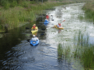
  • within Otty Lake there are 31 islands ranging in size from very small outcrops up to 3.7 ha (9.2 acres)
  • twenty of the islands belong to the province while eleven are privately owned
  • the majority of the shoreline around Otty Lake is privately owned
  • the only public lands on the lake include several islands, the Mica Mines Conservation Area (a portion of which is rented by RVCA to Scouts Canada), and the public boat launch owned by Tay Valley Township
  • public lands near Otty Lake but outside of the watershed boundary include the Perth Wildlife Reserve and Murphy’s Point Provincial Park.
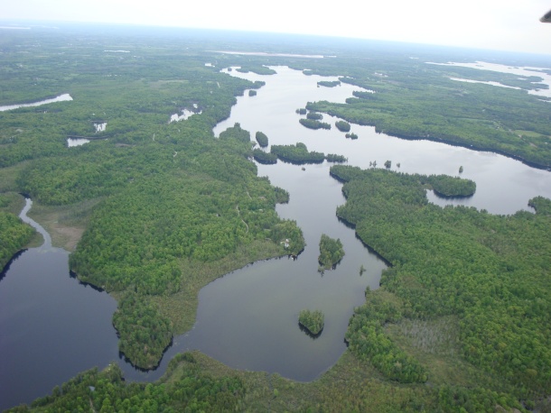
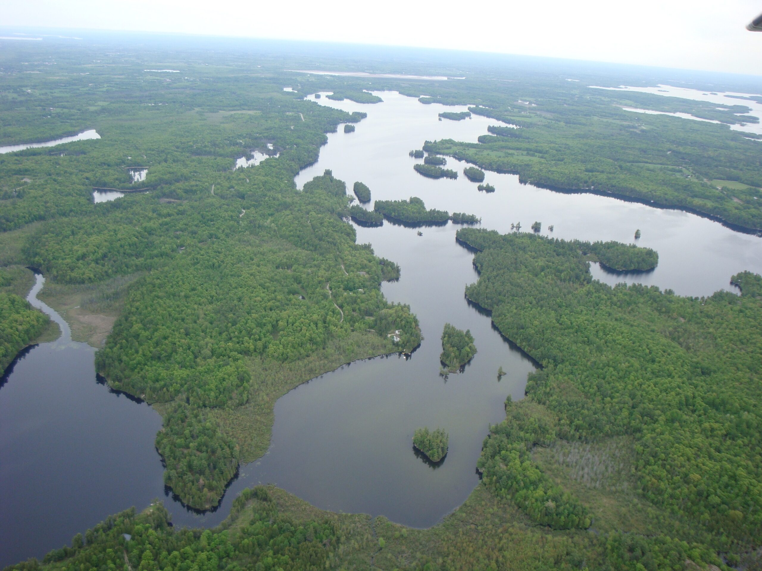
Otty Lake Watershed

  • Otty Lake watershed is one of fourteen smaller watersheds that make up the larger Tay River watershed
  • water water flows out of the watershed through the north end of the lake at Jebbs Creek
  • Jebb’s Creek flows into the Tay River which meets the Rideau River, then north into the Ottawa River and ultimately into the St. Lawrence Seaway and the Atlantic Ocean.
  • total area of the watershed is 49.2 km2 (18.9 sq mi)
  • several small lakes fall within the boundaries of the Otty Lake watershed, including (from south to north): Mills Lake, McLaren Lake, Thoms Mud Lake, Rock Lake, Andrew Lake,  Mud Lake and Doctor Lake, as well as several unnamed wetlands.

Bedrock, Surface Geology and Soil

  • the Otty Lake watershed lies on the edge of the Canadian Shield
  • Canadian Shield areas commonly have steep slopes, thin soil cover, many rock outcrops and poor drainage, creating many localized wetland areas
  • most of the thin layers of silt, sand, gravel and organic material covering the bedrock in the Otty Lake watershed were deposited by glaciers
  • much of the soil is classified as sandy loam and is generally thin (less than 0.9 m (3 ft) deep) although thicker pockets of soil can be found within the irregular landscape
  • areas of the sandy loam soil generally have good drainage while other areas with clay loam may not
  • swamps dominated by acidic organic soils are common in low areas

Mining

  • in 1886 both mica and apatite deposits were discovered near Otty Lake, and a number of mines went into operation
  • apatite is a type of phosphate used in making fertilizer
  • the first recorded commercial shipment of apatite in Canada came from North Burgess Township
  • mica was used in various industrial applications such as electrical insulation
  • sheet mica was used as isinglass, used in stoves, lanterns, and horse-drawn carriages, as it was less likely than glass to shatter with temperature fluctuations
  • several abandoned mica mines can still be found on Otty Lake properties along the Otty Lake North Shore Road and to the south in the Mica Mines Conservation Area

Streams

  • five or more streams drain into Otty Lake
  • three of the streams are seasonal and flow only when there is heavy rainfall
  • two of the streams flow year-round: one drains Thoms Mud Lake and the other drains McLaren Lake
  • more than one quarter (18%) of the watershed is covered in water

Water Exchange Time

  • Otty Lake drains out through Jebbs Creek and runs into the Tay River
  • the outflow of water through Jebbs Creek is not controlled by a dam or other structure
  • because the outflow is generally slow, only approximately 28% of the water in Otty Lake is exchanged for new water annually.
  • the turn-over time for the lake (the length of time required for all water to be replaced with new water) is between 3 and 4.5 years, depending on precipitation and temperature, obstacles to outflow like beaver dams, etc.

Watershed Maps

A map on the Friends of the Tay site shows the 14 smaller watersheds, including the Otty Lake watershed, that make up the Tay watershed.

See the watersheds, including the Tay, that make up the Rideau watershed, on the RVCA site.

Tay River Subwatershed Report 2017: A Report on the Environmental Condition of the Tay River

An RVCA snapshot of 2017 conditions.